By Doyle Irvin, American Forests
Chances are that if you visited me while I lived in the Bay Area, I took you on a hike down the Matt Davis Trail. It’s also likely that there’s an explanation why I’ve done this hike easily 30 times, while neglecting equal due diligence with the rest of Mt. Tam’s stunning hikes — whether its due to my being a creature of habit, a casual-bordering-on-lazy hiker or to the trail itself simply being that addicting… well, you can decide for yourself.
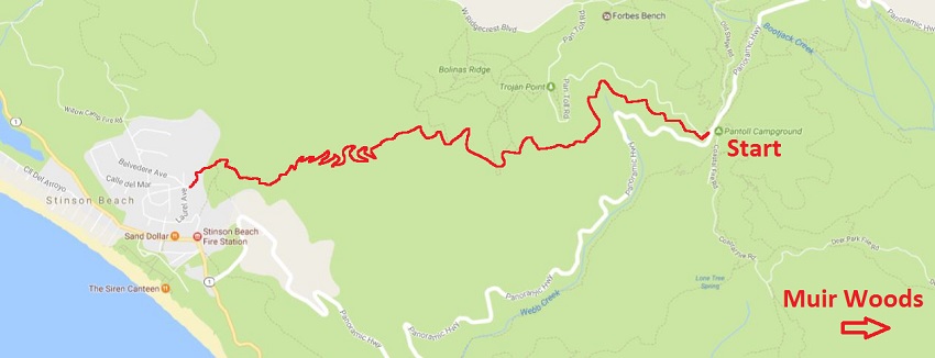

You can park in the Pantoll Campground or the nearby Bootjack Campground. Spots can be pretty rare if you go on one of those days when everyone else is also trying to hike, so sometimes it’s worth planning it out.

When you start the hike, you’re in classic Marin redwoods territory. This photo I particularly like, because the foggy-day hikes can have a spooky aura.

There’s a magic to the greenery, along the trail. This photographer captured another foggy day mystery.

Doesn’t it just feel like these trees are guilty of something? Mossy culprits to the crime?

After hiking through the redwoods and their friends, you come out onto a grassy knoll or two. The transition can be quite abrupt and has stunned a few of my friends. Try to spot the person in this photo!

It’s from these grassy knolls that you will get your first glimpses of the ocean.

The path through the hills will go in and out of forested areas. These forested areas are due to the creeks running down the ravines formed where two hills conjoin. One of my favorite aspects of this hike is the in-and-out nature, where you really feel like you’re traversing different zones.

After the grassy hills, you descend into a forested area that’s wetter and more like a rainforest than the groves around Pantoll. Expect lots of ferns and creeks. This is also the steepest part of the trail – but don’t worry, it all has steps.
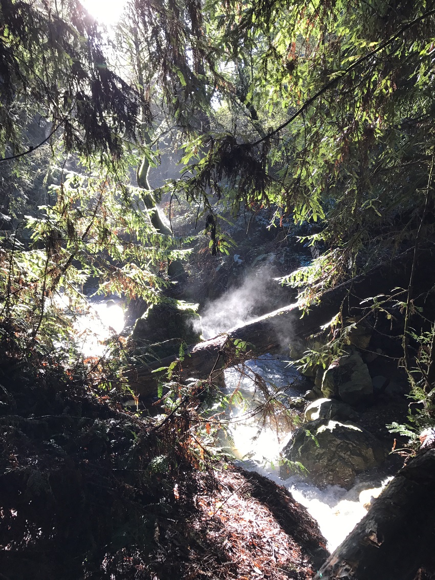
This is one of the many creeks flowing down the mountain. Over the course of the drought, many of these were dry, and it was a sad, sad thing. We’re all happy that it’s raining again.

The end is nearly in sight! Stinson Beach is a small beach community. This photo is from a little south of the town – you might not get to exactly this spot doing the Matt Davis Trail, but will definitely walk by similar vistas.

Do you dare to jump in? It’s safe, I promise. Great whites are our friends.

Your final destination, folks. At the end of this grueling two-hour, all-downhill hike, I like to pretend that I’ve exerted myself and that the only solution is an ocean cleanse. I will then jump in for a grand total of three seconds because the Pacific is cold. This is quickly followed by a large plate of Mexican food and a margarita, at Breakers.