By Nick Del Giudice, American Forests
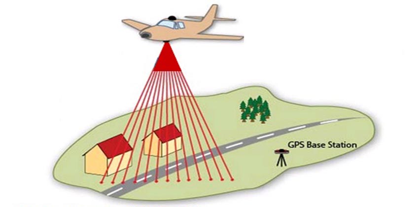
Most people have a heard of sonar or radar detection technology, but few are familiar with their more detailed imaging cousin, LIDAR, short for light detection and ranging. LiDAR is a process by which thousands of lasers are shot out of an aperture, and when the light bounces back, the distance, time, and position of the light traveled are recorded. When the records from these thousands of lasers are collected, they can form stunningly detailed aerial images. The images and light data correspond to GPS data and create a map.
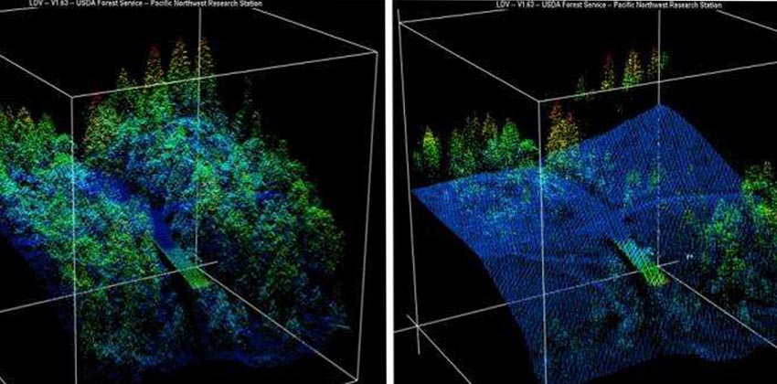
These images can show great detail and trends across an entire landscape, which is why LiDAR is used to survey massive plots of forest. Traditionally, when checking the growth and density of a forest, scores of workers are required to measure each tree manually, a process that is both time- and resource-consuming. With LiDAR however, a few workers and a plane can chart and record a massive swathe of woods. With several years’ worth of mapping done, researchers can identify how much the forest has expanded or retracted, the species composition of the forest, and even the growth rate of an individual tree.
LiDAR was conceived around the same time lasers were invented in the mid-1960s, but truly accurate LiDAR measurement didn’t exist until about 20 years later. Initially, LiDAR was only applied to geological surveying and used in creating accurate topographical maps, as well as in mapping detailed seafloor features. As such, the National Oceanic and Atmospheric Administration was one of the first adopters of LiDAR. The LIDAR apparatus itself is most useful from above, and is predominantly mounted on airplanes, and now even on drones.
With more accurate data on more of our forests, it is possible to tailor management strategies to specifically suit the needs of an entire forest. With the ease of scanning an entire forest from the air for crucial data on its composition, more forests can have scientifically driven management. As LiDAR is used to map more of our forests, our understanding of how to best manage and protect these lands and resources will only get better.