By Dorothy Hastings, American Forests
The world’s tropical forests lost around 39 million acres of trees in 2017, largely due to anthropogenic deforestation, but conservationists are finding hope in using drones to monitor, preserve and even regrow the Earth’s forests and wildlife populations.
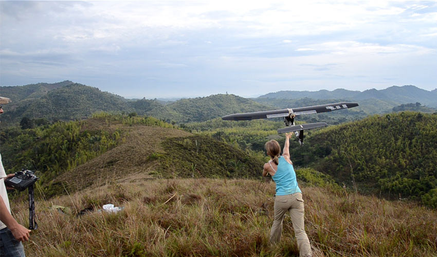
In January 2011, two conservationists met for the first time and changed conservation history. Lian Pin Koh and Serge Wich envisioned an inexpensive way to improve monitoring wildlife in remote regions. One year later, they built and tested the first-ever conservation drone in North Sumatra, Indonesia, and the results were unprecedented.
Most of us have heard about unmanned aerial vehicles (UAV), commonly known as drones, and some of us might even own one. Although drones originated in the military, their use has expanded to include recreational and commercial purposes, and scientific research that can be used to save forests.
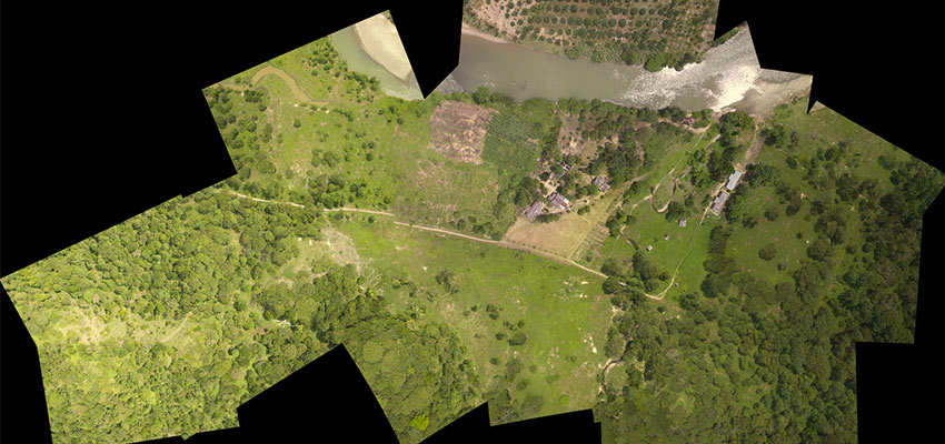
Surveying wildlife is what Koh and Wich had in mind when they designed a low-cost UAV equipped with cameras, sensors and an autopilot system to gather data on declining orangutan populations in Indonesia. The drone flies itself along a pre-mapped route, taking photographs and videos along the way. Alternatives such as satellites, helicopters or counting wildlife populations manually are costly and time consuming, and do not provide high-resolution images or up-to-date data.
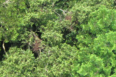
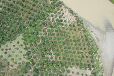
During the test flight in Sumatra, the drone captured videos of oil palm plantations, orangutan nests, and logging and vegetation burning to clear forests for agriculture. It was clear these drones could not only be used for data collection and topography, but also for protecting forests and wildlife from deforestation and illegal activities.
“One of the people we have helped in Indonesia was able to detect loggers encroaching in a national park and also collect evidence of illegal logging within the national park at a small scale,” Koh said, “at a scale where the technology is able to perform well.”
Conservation drones are mainly used for mapping habitats, counting wildlife and patrolling protected areas. Despite the limited flight time of drones due to current battery technology, Koh asserted that conservation drones are making a difference in forests all over the world, and the technology will only continue to improve allowing drones to stay in flight for longer periods of time.
“The other way the technology has been able to address is to help with reforestation,” Koh said. “In places where the forest has already been felled, drones can also be used to try to assess the extent of the forest loss to help with developing plans for reforestation. Some of the more recently developed drones can even be used to shoot capsules or pellets of seedlings or seeds to directly help with the reforestation efforts.”
Wich and Koh started the nonprofit Conservation Drones in 2012 to provide information about using drones for conservation and to train conservationists, nonprofits, and national park personnel on using these drones. They co-authored the book “Conservation Drones: Mapping and Monitoring Biodiversity,” which is the first book that provides information to conservationists and engineers on how to use drones as tools in conservation activities.
” to raise awareness about this technology to people who are not aware of it yet,” Koh said, “and to also hopefully inspire people to think about new technology that could be adapted for conservation use.”
In the U.S., drones are being used for various conservation purposes, by the U.S. Fish and Wildlife Services, the U.S. Department of the Interior, and nonprofit conservation groups.
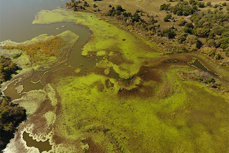
Lake McMurtry Friends, Inc. is a conservation nonprofit organization in Stillwater, Okla., that began using drones for basic video and photography purposes in the maintenance and marketing of Lake McMurtry. In 2017, a team from Lake McMurtry was asked to do an aerial survey at nearby Lake Carl Blackwell to investigate an invasive plant species called yellow floating heart. Jared Avilez, park manager and assistant director of Lake McMurtry Friends, Inc. said using the drone produced prodigious results.
“Part of the problem with this specific plant is if you drive a boat into it that’s going to basically cut the lily pad up and make it reproduce quicker,” Avilez said. “So you can’t really drive a boat into it to see how far up into a tributary the plant has spread.”
Avilez is confident that as drone technology continues to improve, conservationists will regularly be using drones in their work monitoring, mapping and sustaining ecosystems.